Bureau of Land Management
Price Field Office
125 South 600 West
Price, UT 84501
RE: Reconsideration of 2020 San Rafael Desert Travel Management Travel Management Plan
Dear BLM Planning Team:
Please accept this correspondence from the above organizations as our official comments regarding the reconsideration of the 2020 San Rafael Desert (SRD) Travel Management Plan (TMP).
1. Background of Our Organizations
In our comments, the “Organizations” will refer to the following four groups:
Colorado Off Road Enterprise (CORE) is a motorized action group based out of Buena Vista Colorado whose mission is to keep trails open for all users to enjoy. CORE achieves this through trail adoptions, trail maintenance projects, education, stewardship, outreach, and collaborative efforts.
The Colorado Off-Highway Vehicle Coalition (COHVCO) is a grassroots advocacy organization of approximately 2,500 members seeking to represent, assist, educate, and empower all OHV recreationists in the protection and promotion of off-highway motorized recreation throughout Colorado. COHVCO is an environmental organization that advocates and promotes the responsible use and conservation of our public lands and natural resources to preserve their aesthetic and recreational qualities for future generations. COHVCO is a signatory to the subject 2017 settlement agreement that directed the BLM to produce a TMP in the SRD planning area.
Ride with Respect (RwR) was founded in 2002 to conserve shared-use trails and their surroundings. Since then, over 750 individuals have contributed money or volunteered time to the organization. RwR has educated visitors and performed over twenty-thousand hours of high-quality trail work on public lands. RwR has also participated in the Price Resource Management Plan 2008 revision and subsequent amendments.
The Trails Preservation Alliance (TPA) is an advocacy organization created to be a viable partner to public lands managers, working with the United States Forest Service (USFS) and the Bureau of Land Management (BLM) to preserve the sport of motorized trail riding and multiple use recreation. The TPA acts as an advocate for the sport and takes necessary action to ensure that the USFS and BLM allocate a fair and equitable percentage of public lands to diverse multiple-use recreation opportunities. The TPA is a signatory to the subject 2017 settlement agreement that directed the BLM to produce a TMP in the SRD planning area.
The Organizations and its contributors, along with local OHV clubs like Sage Riders Motorcycle Club and Castle Country OHV Association, have enjoyed riding for generations in the SRD, including on the 195 miles of routes to be reconsidered. Use rose in the 1970s, including BLM-permitted motorcycle races called the annual Mail Run that ran for a decade, which included racing down the entire length of Cottonwood Wash. Use of this and other routes remained strong through the 1990’s and 2000’s until the BLM technically closed the vast majority of SRD routes in 2008. Some of our contributors helped the BLM to inventory routes in the SRD. After passage of the Dingell Act in 2019, use in the SRD (other than the part designated as Labyrinth Canyon Wilderness), use has slowly but surely started to return. After approval of the 2020 SRD TMP, some of our contributors assisted the BLM to start implementing the decision, including on some of the reconsideration routes.
2. Introduction
In good faith, the Organizations will take the BLM’s invitation to comment on its preliminary proposal to close most of 195 miles designated open in the 2020 SRD TMP but then slated for reconsideration by the 2022 settlement agreement. First, though, we should recall how access to existing routes in this planning area has been tied up for fourteen years and counting. The 2008 RMP simply did not produce a complete, coherent, or legally defensible TMP in the SRD. In fact, it didn’t even produce an inventory of the existing routes. Instead it pledged to do a proper TMP in the SRD within five years, asking the public to comply with an incomplete TMP in the meantime. This timeline was stalled by several rounds of settlement talks with wilderness-expansion groups stemming from a partially-adverse ruling of the Richfield RMP, which managed to wrap the SRD TMP into the 2017 settlement agreement.
The Dingell Act designated approximately 660,000 acres of Wilderness in Emery County, including the Labyrinth Canyon Wilderness in the SRD planning area that removed 80 miles of existing routes from further consideration, which were some of the best routes. The remainder of this planning area became increasingly important for motorized recreation displaced by the wilderness designation that closed hundreds of miles of existing routes across Emery County. Fortunately the SRD has fewer natural- or social-resource concerns than the Wilderness areas, so we expected a high density of routes to be designated.
The 2020 SRD TMP designated 767 miles of route open but, especially considering that many of these miles actually consist of state/federal highways for which the BLM has no jurisdiction, 767 miles is actually a low density of routes across a 377,609 planning area. The Organizations chose not to appeal the 2020 decision largely because we prefer to work with the BLM and fix shortcomings through subsequent planning to enhance the TMP. However wilderness-expansion groups appealed to the IBLA and, thanks to our work as defendant intervenors, their request for a stay of the 2020 SRD TMP was denied. Under a new administration, the BLM chose not to implement its TMP anyway, even rejecting volunteer help from us and local OHV clubs. The wilderness-expansion groups switched to an appeal in federal court, and the BLM reached a settlement with them to the complete exclusion of OHV groups, Emery County, or the State of Utah. This 2022 settlement agreement was approved primarily because the BLM claimed not to have pre-determined the fate of the 195 miles of routes to be reconsidered.
Likewise the BLM claimed that its emergency closure of 35 miles of routes last January (a) would be temporary, (b) was unrelated to the settlement with wilderness-expansion groups, and (c) likewise would undergo subsequent planning for which the BLM claimed not to have pre-determined the fate of the 35 miles under emergency closure. The organizations are currently appealing the emergency closure in large part because the BLM has indicated that its purpose is to protect vegetation growing within the 35 miles of route, most of which are old bladed roads or parts of motorcycle race courses permitted by the BLM. Vegetation surveys of these routes suggest that the plants are common, not threatened or endangered species, and that the population of common plants would not have considerable adverse effects from use of the routes. Further, managers should expect the presence of vegetation on routes that were technically closed by the 2008 SRD TMP, especially since much of the planning area is dominated by migrating sand dunes.
Perplexingly the ePlanning site for reconsidering 195 miles of routes designated open by the 2020 TMP barely mentions that 35 miles of them are actually closed. The BLM has provided no evidence that vegetation on these routes should be a management concern yet, particularly on routes with vegetation, the BLM’s preliminary proposal favors closure. Proposing to close most of the 195 miles of routes suggests that the 2022 settlement agreement was prejudiced and pre-decisional, in violation of NEPA. Proposing to permanently close all 35 miles of routes suggests that the “temporary” closure last January likewise had a pre-decisional prejudice toward a “permanent” closure in violation of the letter and intent of the “temporary” closure regulation. This impression is reinforced by the fact that no data or rationale from additional field work has been provided to justify this proposal to close another hundred-plus miles of routes in the SRD. This lack of explanation seriously hampers our ability to meaningfully comment on your preliminary proposal.
The BLM has thus far refrained from outlining a normal process of travel planning that would provide full analysis and ample opportunity for the public to comment on it. We strongly urge you to propose leaving most if not all of the routes open, provide complete rationale for any additional closures, and give us plenty of time to review it before you make a final decision. Anything less would undermine the legitimacy of your flurry of SRD activity in the legal realm, which is in stark contrast to the lack of implementation activity for two years, as off-highway vehicle riders have patiently and constructively worked with your planners in the SRD for the past fourteen years.
3. Specific Comments
One month—the hottest month of year—has not been enough time to review the BLM’s preliminary proposal, so we are focusing on the most concerning routes that you propose to close. Please know that we support all of the routes that you propose to leave open, as most of them have great purpose and need. We also support the August 1st comments from the Sage Riders Motorcycle Club that primarily highlight some of the most important routes that you propose to leave open, and have enclosed them, as we request that you consider them as part of our own comments.
Likewise please consider as part of our comments the ones we submitted in regard to:
- 2020-10-29 “Opposition to Petition for Stay” as defendant intervenors in the wilderness-expansion groups’ appeal of the 2020 SRD TMP,
- 2022-04-11 Opposition to 2022 settlement agreement between the BLM and wilderness-expansion groups, and
- 2022-05-31 “Appellants’ Statement of Standing and Statement of Reasons for Appeal of the Temporary Closure Order”.
In particular, note the 2022-05-31 document and associated declarations regarding the 35 miles of temporarily-closed routes, which refute BLM claims that the routes “have fully reclaimed, are not apparent on the ground, or are otherwise inaccessible by routes authorized for public OHV use” and that use of the routes “will cause considerable adverse effects to resources including, but not limited to, soil and vegetation.”
In fact, the Organizations refute any similar claims that the BLM may apply to the remainder of the 195 miles of routes to be reconsidered. The reconsideration routes almost entirely avoid riparian areas. They cross areas that the 2008 RMP determined to have wilderness characteristics, but it also determined not to manage for those characteristics (other than a small portion of what has subsequently been designated as Labyrinth Canyon Wilderness), so closing more routes in order to increase wilderness characteristics should only be done in the planning area after amending the 2008 RMP accordingly. Views of the Green River are a virtue of a few reconsideration routes and, even cumulatively, they don’t cause considerable adverse impacts upon river use. Further, the Dingell Act designated most stretches of the Green River as some type of Wild And Scenic River. It did not make such a designation for the stretch where the BLM’s preliminary proposal would close more routes, so the BLM should recognize those routes as entirely suitable for motorized recreationists to view the river.
The existence of vegetation on designated routes is not a sufficient reason to close the routes, nor does it prove that the routes are unused, nor does it prove that the routes are valueless (i.e. lack a purpose or need at present or in future). For example, many segments of routinely graded, Class B roads in this planning area are currently covered in vegetation, such as SD211 and SD212 (see photos of both routes taken on August 7th, 2022). Especially since most routes in the planning area have been technically closed since 2008 (which most of the public honored even though the closure was not legally defensible due to the TMP in this planning area being blatantly incomplete and incoherent), it is high time for the BLM to stop closing more routes for the sake of common plants growing on old bull-dozed roads and permitted motorcycle-race courses, and to start managing use on the ground for the first time in the history of the San Rafael Desert.
In all cases listed below, the photos demonstrate that the routes are apparent. Compared to the nearby graded roads, the routes provide a more primitive experience, some degree of intimacy with the surroundings, and a sense of challenge or flow. A quality OHV ride depends on piecing these primitive routes together without graded roads while including enough points of interest and variety of terrain.
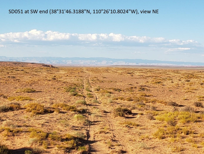
SD051 and SD052 (See photo of SD051 in this document.)
These routes provide a more primitive alternative to Hans Flat Road.
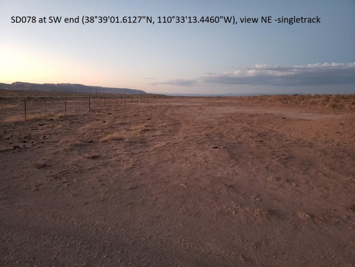
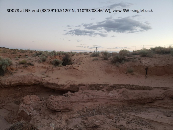
SD078 (See both photos and satellite image in this document.)
This route provides convenient access to Temple Wash. As with many areas adjacent to a highway corridor, it is denuded, although a singletrack is surrounded by some degree of vegetation. At its north end, the downed fence has a gate indicating where the route went through the gate. Recent scouring of Temple Wash below the highway bridge may impede larger vehicles, but smaller vehicles can already get through all of SD078, and larger vehicles could do so after basic tread work with support of local OHV clubs or the state’s OHV program.
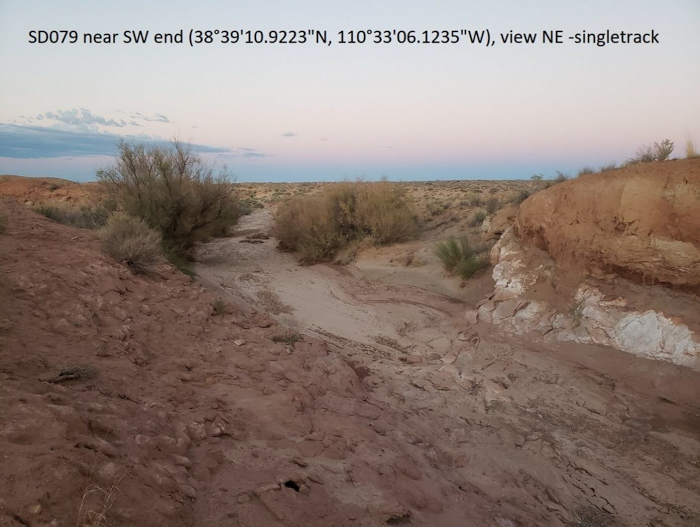
SD079 (See photo and satellite image in this document.)
Temple Wash has been permitted by the BLM for motorcycle races, and provides a dynamic challenge and flow that has become scarce as most other washes have been closed. This stretch of wash generally lacks riparian resources that may otherwise cause concern. Recent scouring of Temple Wash below the highway bridge may impede larger vehicles, but smaller vehicles can already get through all of SD079, and larger vehicles could do so after basic tread work with support of local OHV clubs or the state’s OHV program.
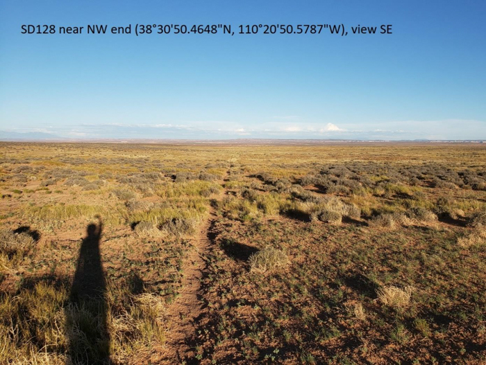
SD128 and SD319 (See photo of SD128 in this document and of SD319 in 2022-05-31 Declaration of Clif Koontz.)
Bypassing the highly-developed Hans Flat Road, these routes connect two highlights of the San Rafael Desert (at least of the part that hasn’t been permanently closed by wilderness designation), specifically Sweetwater Reef overlook and Jack’s Knob. Most of the route is on SITLA property, which has no other motorized access under the BLM’s preliminary proposal.
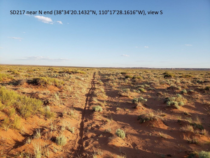
SD217 (See photo in this document.)
This route may seem redundant with SD309, but if you’re coming from SD326 (from Wayne County / Richfield FO) and you want to head north (to Moonshine Well), reaching SD309 via SD312 would seem circuitous to any group that’s hurrying for whatever reason.
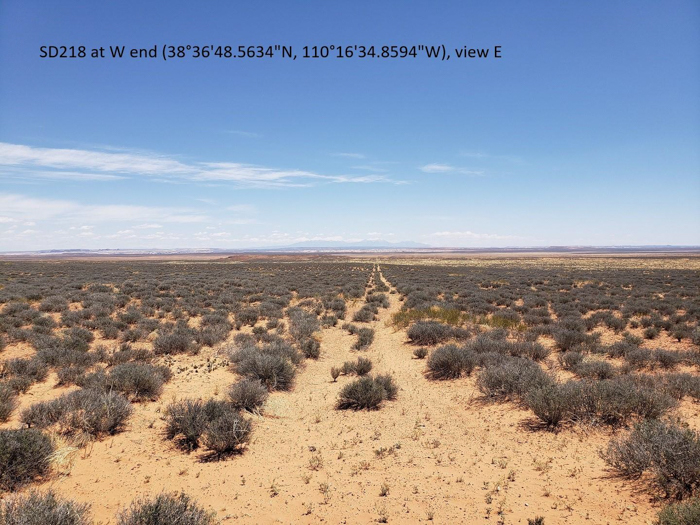
SD218 to SD372 (See photo of SD218 in this document and of SD372 in 2022-05-31 Declaration of Clif Koontz.)
This pair of routes primarily consists of a single, straight seismic line that provides the only east-west travel across a north-south expanse of over ten miles (from SD543 into Wayne County / Richfield FO) covering most of Antelope Valley. Although parts of the route are much less apparent, route markers could be placed at regular intervals to organize travel. It accesses the corner of a SITLA section.
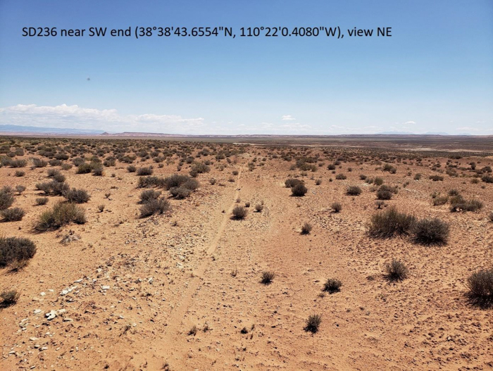
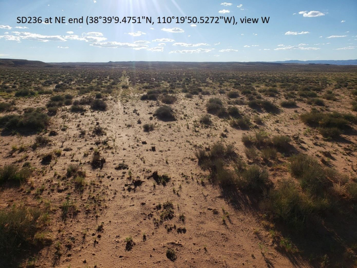
SD236 (See both photos in this document.)
This route is an alternative to the graded road, going across the shallow-yet-interesting canyon of Dugout Wash as well as a slickrock expanse, both of which nicely contrast the predominantly flat and sandy planning area.
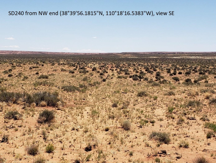
SD240 (See photo in this document.)
This route is an alternative to the graded road, providing over two miles of primitive road.
SD250 (See photo in 2022-05-31 Declaration of Clif Koontz.)
This route accesses SITLA property and the small-but-scenic Red Reef, which also makes the route itself more rolling and interesting.
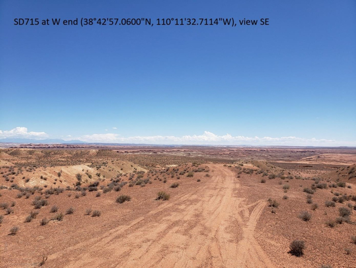
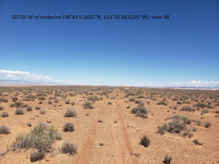
SD715 and SD720 (See photos of SD715 and SD720 in this document.)
This route traverses the southeast rim of Gruvers Mesa, providing views that are different from the route on the northwest rim. The end the road, which accesses SITLA property, is particularly scenic.
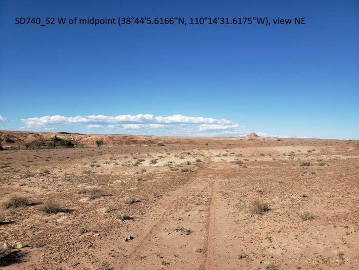
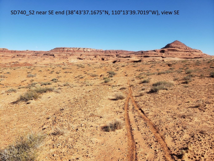
SD740_S2 (See both photos in this document.)
This route is part of a short-but-great loop partly due to the rolling terrain. Its southeast end offers views up to The Cone, while the northwest end offers views down to the San Rafael River (while generally staying back off of its rim). The route is entirely passable by motorcycle, and could be made more accessible to larger vehicles by doing basic tread work with support of local OHV clubs or the state’s OHV program. The middle part could easily be realigned to reduce the grade for sustainability, but this shouldn’t be an immediate concern due to the low use levels associated with such a remote location. Note that SD741 is also a high-quality route but, given the SD740 already provides views of the San Rafael River in a loop, the SD741 spur is not as important.
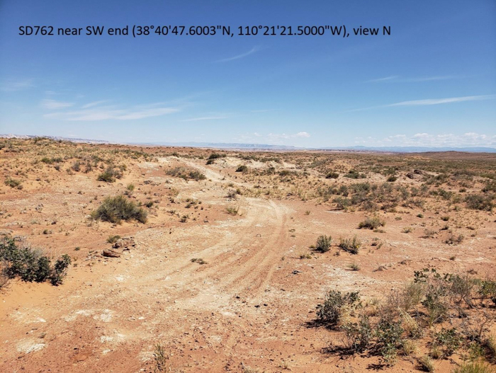
SD762 (See photo in this document.)
This route creates a loop with SD210, which is a five-mile route that would otherwise be one-way. This loop is a more interesting way to reach the San Rafael River overlook of SD763. Although parts of the route are much less apparent, route markers could be placed at regular intervals to organize travel.
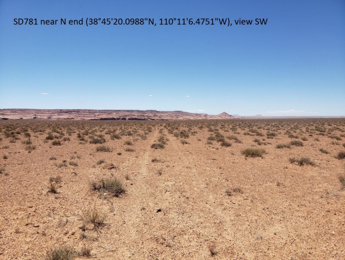
SD781 (See photo in this document.)
This route creates a loop to a view of the San Rafael River from the river’s north side. It traverses rolling red-rock terrain off the flank of Horse Bench that makes for a high-quality route.
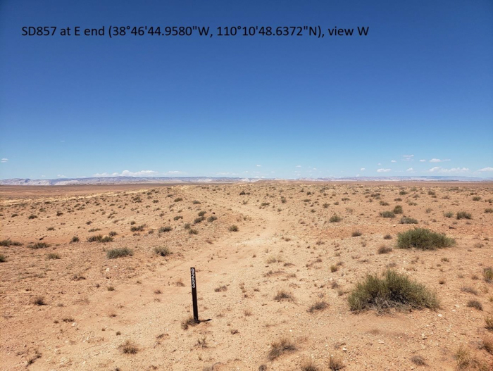
SD857 and SD858 (See photo of SD857 in this document.)
This pair of routes makes a larger loop out of the same one as SD781 that reaches a view of the San Rafael River from the river’s north side. It also reaches the corner of a SITLA section.
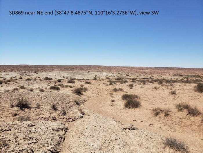
SD869 and SD870 (See photo of SD869 in this document.)
This pair of routes reaches SITLA property and a point overlooking the San Rafael Valley as well as the geologic transitions from the sandstone formations southward and the shale formations northward.
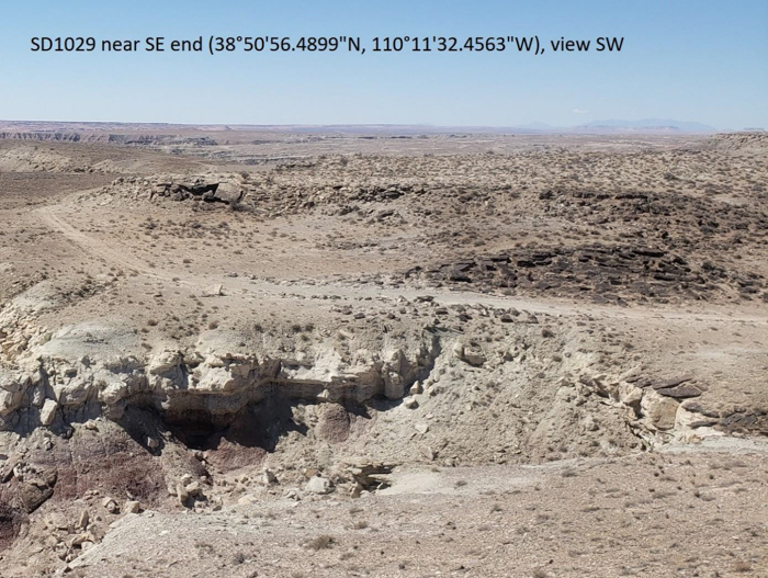
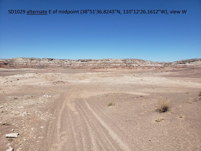
SD1029 (See photos and satellite image of SD1029 and SD1029 alternate.)
This route meanders through badlands of the Morrison Formation to reach SITLA property and a panoramic view of Dry Lake Wash and beyond. Since this area is nearly void of vegetation, the Organizations are wondering why the BLM would preliminarily propose to close it (even more than we’re wondering why all the other closures are proposed). Perhaps it’s because the wash where the route begins is so broad that the route is less distinct. This shouldn’t be an immediate concern given that the area is naturally barren, but eventually you could reroute it to the existing primitive road that lies a quarter-mile northward. It’s a more distinct route that stays even further away from Horse Bench Reservoir.
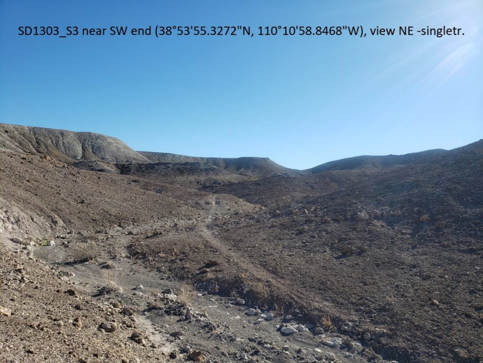
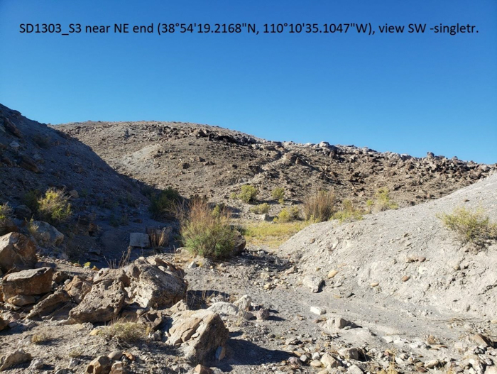
SD1303_S3 (See both photos in this document.)
This route gradually winds up a hill and then down the other side to the Green River. If there are noise concerns along the river (despite that the river will continue to be used by motorboats), note that vehicle sounds from SD1303_3 are drowned out by the loud diesel of major irrigation-water pumps a couple-hundred yards upstream. If there are concerns about the route dropping down to river-bank level, the BLM could close the last hundred yards of the route so that OHV riders could still view the river from atop the small rim.
In addition to the routes listed above, the 2022-05-31 Declaration of Clif Koontz includes photos of the following routes:
SD143
SD182
SD221
SD236
SD303
SD335
SD345
SD346
SD396
SD759
SD940
The photos document the apparency of these routes, which have a purpose and need by providing things like singletrack character (e.g. SD940 that was permitted by the BLM for motorcycle races) and a primitive alternative to graded roads (e.g. SD221 to SD335 as well as SD345 to SD346).
4. Conclusion
Keeping these routes open, along with the ones that your preliminary proposal already would keep open, is key to conserving a modest quantity and quality of routes for piecing together a weekend’s worth OHV rides in the San Rafael Desert. We implore you to accommodate this type of recreation considering the context of increasing use and decreasing access.
Sincerely,
Clif Koontz
Executive Director
Ride with Respect
Chad Hixon
Executive Director
Trails Preservation Alliance
Marcus Trusty
President/Founder
Colorado Off Road Enterprise
Scott Jones, Esq.
Authorized Representative
Colorado Off-Highway Vehicle Coalition